
Learn · Everyday know-how · Lesson 6 of 6
Fix common problems
You willFind out why something is missing, cluttered, the wrong size or not responding, and put it right.
Time4 min
Why it mattersMost “it’s broken” moments are a hidden layer, a missing scale or a blocked permission, each fixed in seconds.
Try it in Plotlay → Opens an example project with this lesson beside it. Nothing to install.
Steps
- Something missing on the plan or in 3D? Open the Layers tab and show its layer again with the eye beside its name. In 3D, a note says when a hidden layer holds things, with Show them.
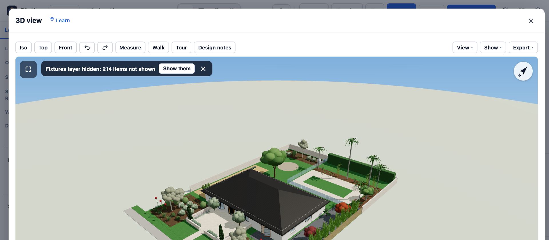
- Still missing? It may be on another building level. Pick the level on the map, or search for its name with Ctrl+K.
- Too many labels? Choose Labels and untick the types you don’t need.
- Keys do nothing in 3D? Click inside the view first, so it has the keyboard. Esc gives the pointer back.
- Sizes in pixels on a plan from a drawing? It has no scale yet: choose Set scale and click two points a known distance apart.
- GPS says location is blocked, or the ± stays large? Allow location for the site in the browser’s settings, and step into the open.
- A project has gone? Projects not in your account live in one browser: clearing site data or closing a private window removes them. Sign in, or keep a copy: Export, then Share and Project file.
Tips
- An export without the aerial? Some base maps’ terms forbid their imagery in exports, and Plotlay says so. Switch to a base map that allows it, such as a government aerial.
- Slow 3D on an older computer: close other tabs and make the window smaller.
- Still stuck? Search the lessons with Ctrl+K, or email hello@plotlay.io with what you did and what you saw.
Common mistakes
- Deleting and redrawing something that was only hidden: check Layers and the level first.
- Clearing the browser’s data to fix a problem: it deletes projects that are only in this browser. Export a project file first.
Words in this lesson
- Layer
- A group of things in a project, listed in the Layers tab. A hidden layer is left out of the plan, 3D and documents until you show it again.
- Level
- A floor of the building, such as ground or upper. Each room, drawing and item sits on one level, and the plan shows one level at a time.
- Accuracy (±)
- How far out a GPS position may be, such as ± 4 m. Smaller is better; under 5 m is good for a phone.
Related lessons
Show the labels you needShow or hide labels by type, and let Plotlay thin them out as you zoom, so a busy plan stays readable.2 minUndo, redo and go back in HistoryTake back a mistake, or return the project to an earlier point.2 minWork without signalGet a project ready for a site with no signal, work there, and let it sync when you are back.3 min
Steps checked in the app on 14 October 2026.