
Learn · Everyday know-how · Lesson 1 of 6
Bring files into Plotlay
You willBring in a drawing to pin, a photo, a list of assets or a whole project file, each in the right place.
Time4 min
Why it mattersEach kind of file has its own door: use the right one and it lands in place, with nothing to redo.
Try it in Plotlay → Opens an example project with this lesson beside it. Nothing to install.
Steps
- A floor plan, site plan, PDF or DXF to draw over: choose Overlay in the top bar (Add overlay on a wide screen), then Drawing or image file. It lands in view, ready for Pin to map….
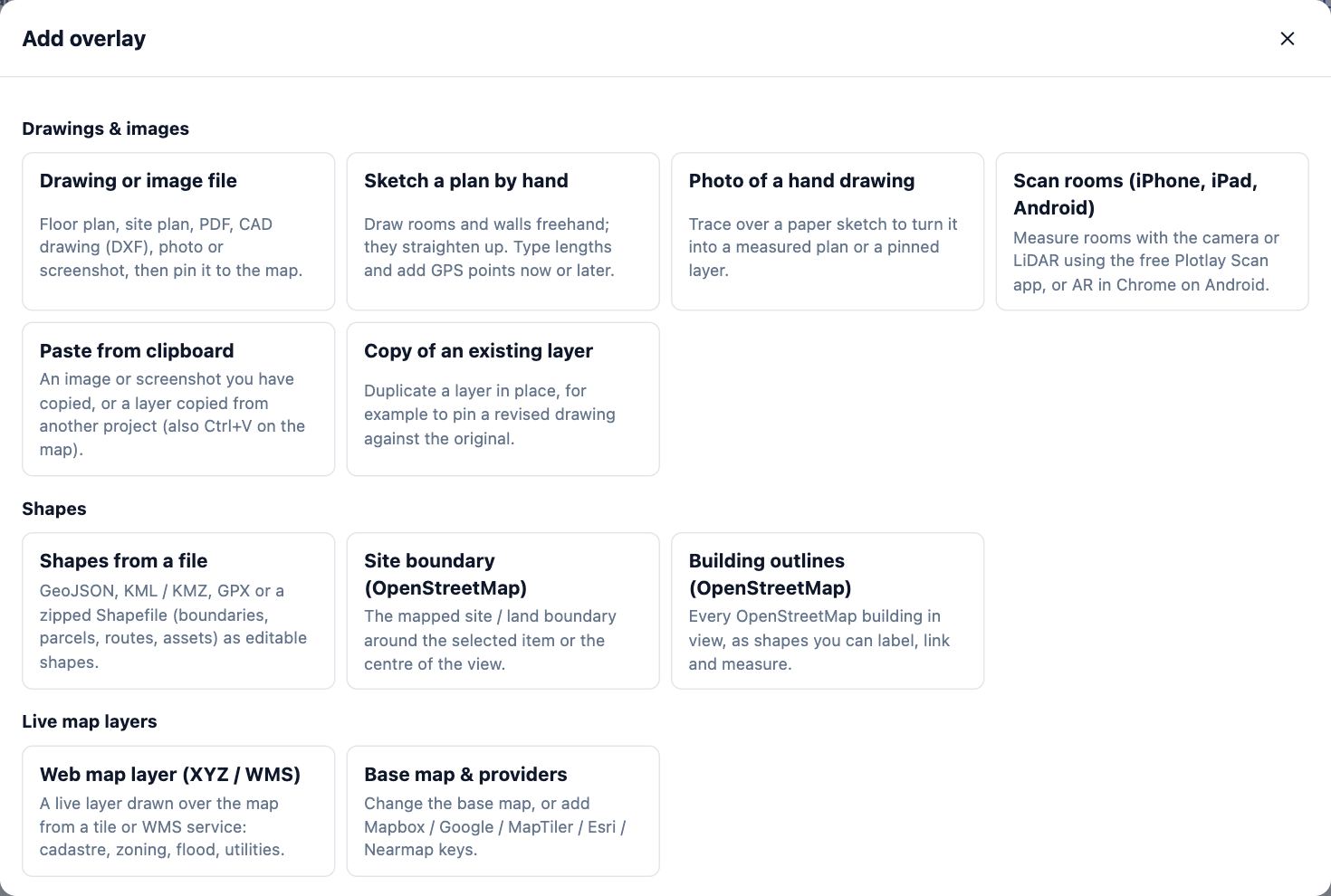
- A photo goes in the same way. A photo with a GPS tag starts where it was taken; Put it in view instead brings it to the middle of the screen.
- Map data (GeoJSON, KML, KMZ, GPX or a zipped Shapefile): in Add overlay, choose Shapes from a file. Each feature becomes a shape you can edit.
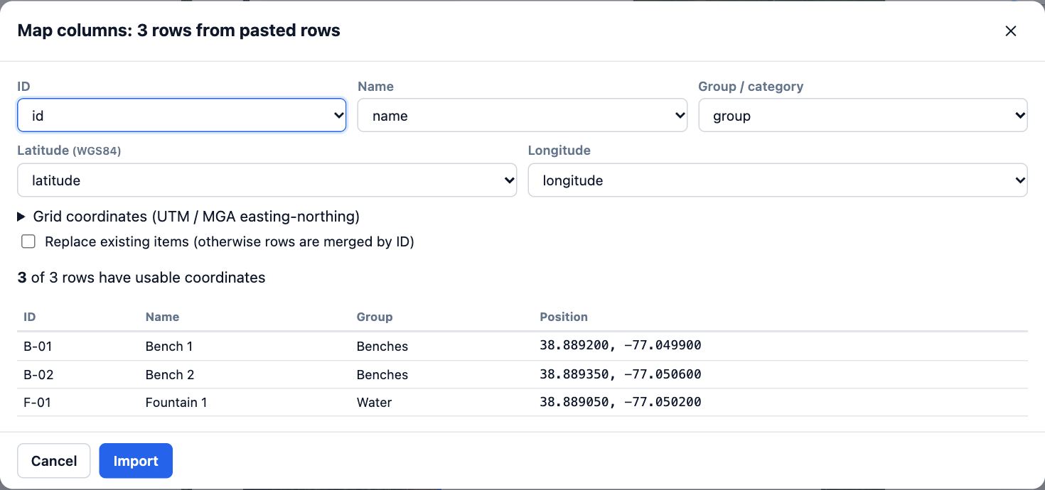
- A list of assets (CSV, Excel, GeoJSON or KML points): choose Import in the top bar, then Choose a file, or paste rows from a spreadsheet and choose Next.
- Check the columns Plotlay matched (ID, Name, Group, Latitude, Longitude, or easting and northing) and choose Import. Every other column is kept on each item.
- A whole project from another computer: on the dashboard, under Open a project file, choose Open file…. It opens as a new project.
Tips
- A DXF drawn in MGA or UTM grid coordinates places itself. Other drawings need Pin to map… (see the pin a plan lesson).
- Starting from a drawing? On the dashboard, Plan from a drawing makes the drawing the base of a new project instead of an overlay.
- A screenshot on the clipboard pastes straight onto the map with Ctrl+V.
Common mistakes
- A DWG file: Plotlay reads DXF. Save the drawing as DXF in your CAD program first.
- Choosing Shapes from a file on a plan that isn’t on the map: shape files carry real coordinates, so pin the base drawing to the map first, or use a map project.
- Eastings and northings in the wrong zone: set UTM zone before you choose Import. Zone 54 south is the default.
Words in this lesson
- Overlay
- A drawing, plan or picture laid over the map or plan, such as a site plan PDF or a DXF. Pin it to line it up with the aerial.
- Pin (control point)
- A pair of matching points, one on a drawing and one on the map, that places the drawing. Two pins place it; a third shows how well it fits.
- Guest roles
- What a person you invite may do: Can view (look and walk through), Can comment and pick options, or Can edit. Viewers need no account.
Related lessons
Pin a plan or drawing to the mapLine a site plan, floor plan or PDF up on the aerial by matching two or three points.5 minWork through an asset register on siteVisit each asset in turn, nearest first, and record where it is, its form answers or that it is missing.5 minStart, name and manage projectsStart a plan, give it a name, then duplicate or delete it from your project list.2 min
Steps checked in the app on 14 October 2026.