
Learn · Councils and development applications · Lesson 1 of 5
Pin a plan or drawing to the map
You willLine a site plan, floor plan or PDF up on the aerial by matching two or three points.
Time5 min
Try it in Plotlay → Opens an example project with this lesson beside it. Nothing to install.
Steps
- In a map project, find the address, then choose Add overlay (Overlay on a narrow screen) and Drawing or image file. Pick the PDF, image or DXF. It lands roughly in view.
- With the drawing selected, choose Pin to map… in the panel on the right. The drawing and the map open side by side.
- Click a crisp point on the drawing, such as an outside building corner, then click the same point on the map.
- Do the same for a second point far from the first. Two pairs place it; a third checks the fit and shows each pin’s error.
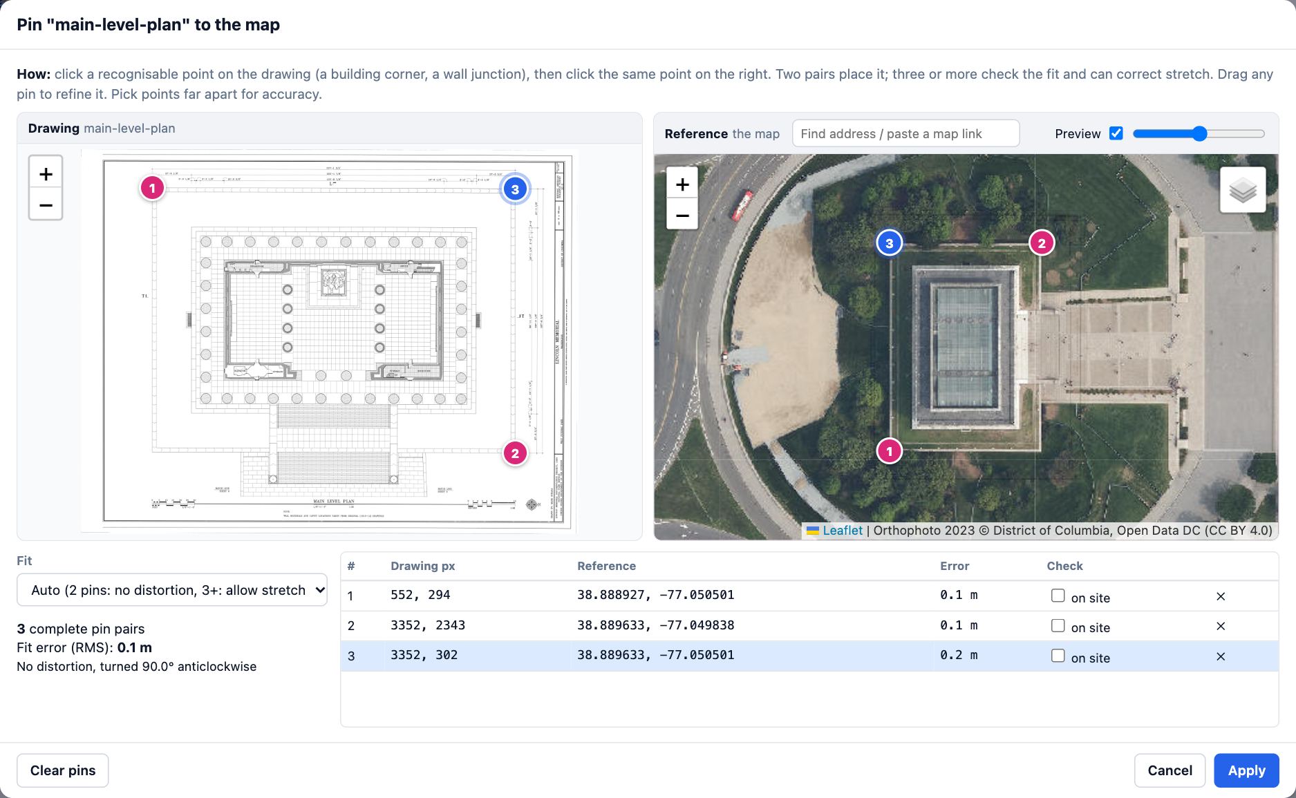
- If one pin is metres out while the others are close, you clicked the wrong corner: drag it, or choose Clear pins and start again.
- Choose Apply. The pins stay with the drawing, so you can come back to Pin to map… and refine them.
Tips
- Use outside corners of walls or kerbs, not roof edges or shadows: roofs overhang and shadows move.
- Choose Linework (hide white paper) under Blend so only the lines show over the aerial.
- A drawing drawn in MGA or UTM coordinates (a surveyor’s DXF) places itself, with no pins.
Common mistakes
- Picking two points close together: small clicking errors then turn the whole drawing. Pick points far apart.
- Pinning to a satellite image that leans: tall buildings lean in aerials, so pin at ground level.
Related lessons
Record the site and its boundaryEnter the address, zone, overlays, street boundary and survey facts the application is assessed on.3 minDimension the setbacksAdd a dimension from the house to each side of the site boundary, and read the distances.2 minMeasure a room and type it inTurn tape measurements of a room into a room on the plan, with its area and perimeter.4 min
Steps checked in the app on 14 October 2026.