
Learn · Field and asset teams · Lesson 3 of 6
Save a map area for offline
You willKeep the aerial for a site on your device, so the map shows without signal.
Time3 min
Try it in Plotlay → Opens an example project with this lesson beside it. Nothing to install.
Steps
- Open the project and zoom to the area you will visit. Use a base map that may be saved, such as a government aerial (DC 8 cm here; NSW aerial imagery in New South Wales).
- Choose the Map tab on the left. Under Offline, choose Save this area offline.
- Give it a name and choose the Detail: each level closer has about four times the tiles. The dialog shows the tile count and size.
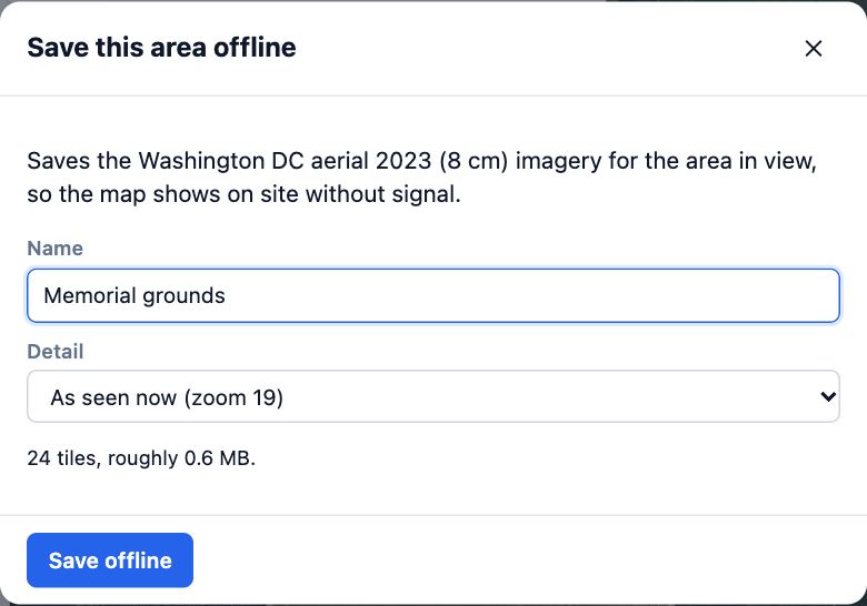
- Choose Save offline and keep the tab open until it finishes. The area is then listed under Offline; click its name to show it.
- Choose Install the app (on iPhone, Share then Add to Home Screen), so the browser keeps the saved map.
Tips
- Your projects, drawings and photos work offline already. Only the base map needs saving.
- Tiles you have looked at are kept too, so panning round the site once before you leave also helps.
Common mistakes
- Trying to save Street or Satellite: their terms don’t allow bulk downloads, so Plotlay says so instead. Switch to a government aerial first.
- Choosing the most detail for a whole suburb: the area becomes too large. Zoom in to the site first.
Related lessons
Capture a GPS point on siteSave a point where you stand, with its accuracy, time and a name.3 minWork through an asset register on siteVisit each asset in turn, nearest first, and record where it is, its form answers or that it is missing.5 minAsk someone on site for a scanMark the rooms on a floor plan and send a request; their scan comes back lined up with your plan.4 min
Steps checked in the app on 14 October 2026.