
Learn · Field and asset teams · Lesson 1 of 6
Capture a GPS point on site
You willSave a point where you stand, with its accuracy, time and a name.
Time3 min
Try it in Plotlay → Opens Plotlay with this lesson beside it. Nothing to install.
Steps
- On the dashboard, under What do you want to do?, choose Capture a GPS point. A map project opens at your position. In a project you already have, choose Capture, then Start GPS.
- Allow location when the browser asks. A blue dot shows where you are, inside a circle of how far out it may be.
- Wait for the number at the bottom left of the bar, such as ± 4.0 m, to settle. Smaller is better: under 5 m is good for a phone.
- Stand on the spot and choose Capture a point here (or Capture here on the card).
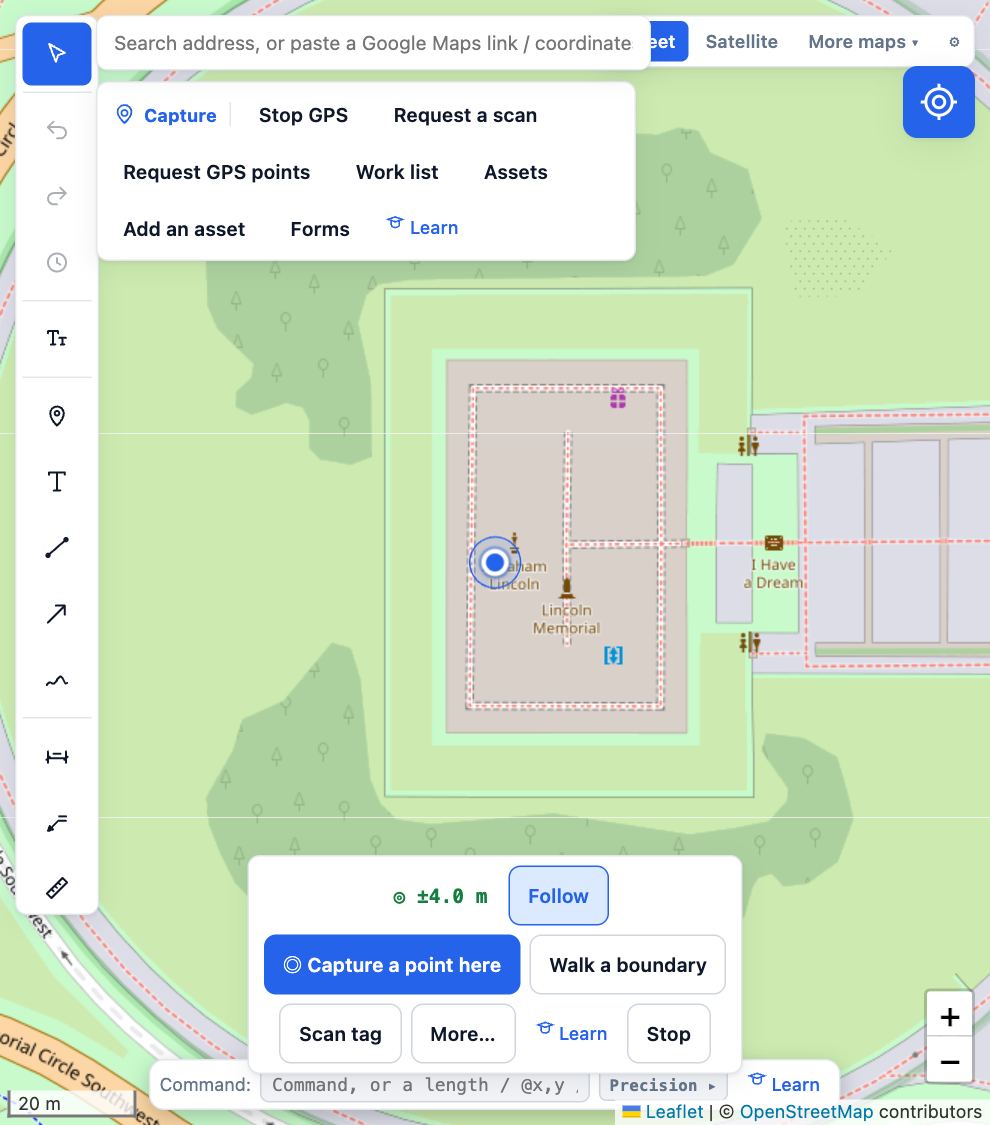
- Type a name such as Bench 3 and choose Save. The point keeps its accuracy, the time and how it was captured.
- Choose Stop when you are done, to save the battery.
Tips
- For a steadier position on an asset you have selected, choose More… in the bar, then Average position. It records for a few seconds and keeps the honest accuracy.
- Choose the accuracy number itself to set an accuracy target for the project, or to connect a GNSS receiver.
- Indoors, under trees or beside tall buildings a phone is often 10 to 30 m out. Step into the open if you can.
Common mistakes
- Capturing before the number settles: the first fix is often the worst. Give it ten seconds.
- Location blocked: if you chose Block, allow it again for app.plotlay.io in the browser’s site settings.
Related lessons
Work through an asset register on siteVisit each asset in turn, nearest first, and record where it is, its form answers or that it is missing.5 minSet up asset formsChoose the questions to answer about each kind of asset on site, with required answers and photos.4 minSave a map area for offlineKeep the aerial for a site on your device, so the map shows without signal.3 min
Steps checked in the app on 14 October 2026.