
Guide 3 · field
Verify an asset register on site
Open this example in Plotlay → The same project, ready to explore. Nothing to install.
You have a register, or a list of requested points, and some of it is wrong. Some assets have coordinates, some don't, some have moved, some are gone, and there are things on site nobody recorded. This is the workflow, on a phone, with a real example: the park furniture around the Lincoln Memorial.
Download the example: lincoln-grounds-register.csv: 9 benches, 7 litter bins and 4 drinking fountains (positions from OpenStreetMap, © OpenStreetMap contributors, ODbL), plus three legacy entries with no coordinates.
Before you go
- Import the list. Add → Asset or site list (CSV, Excel, GeoJSON or KML). Columns like
id,name,lat/lngor easting/northing are matched automatically; every other column comes along. - Choose a base map you can read on site, such as an aerial for outdoor assets.
- Sync to the cloud if more than one phone is working the list, or so the office sees results as they come in.
- Add the app to your home screen. Map tiles you've looked at stay available offline.
On site
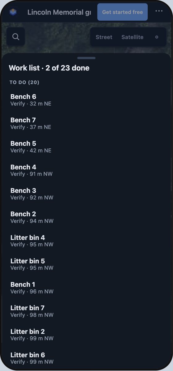
- Field → Work through a list. Everything, only the ones to locate, only the ones to verify, or list order. Nearest comes first.
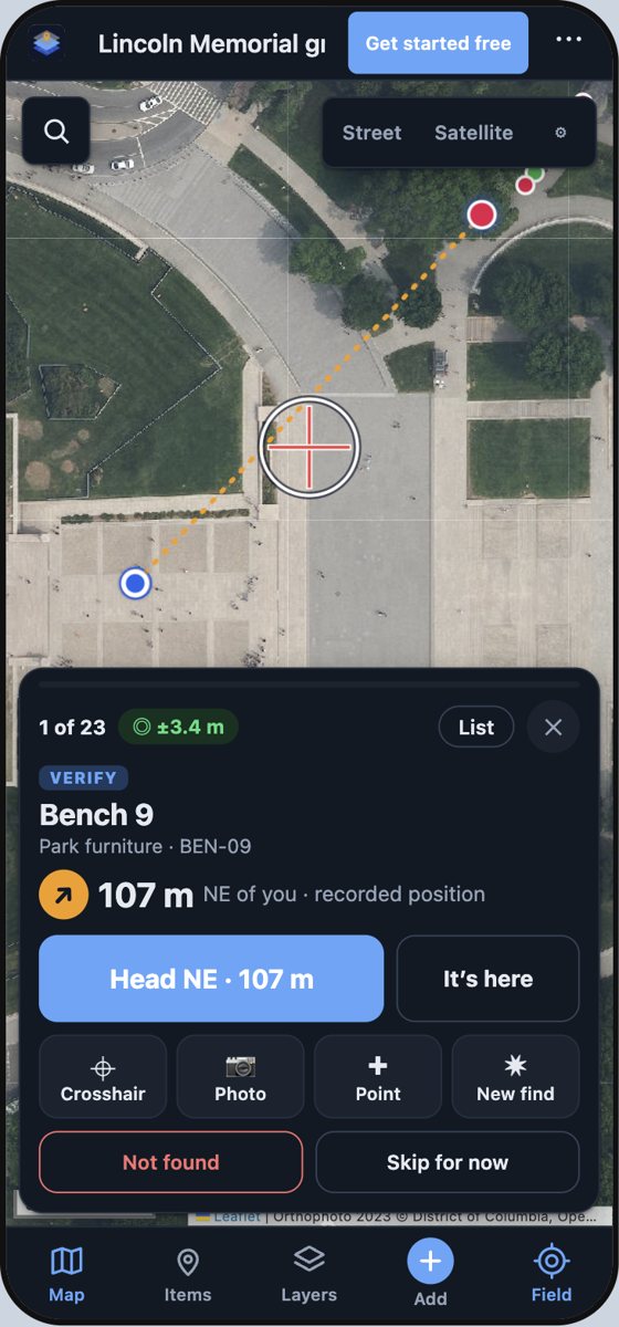
- Head there. For an asset with recorded coordinates the card shows distance and direction and draws a guide line; while you're clearly not there, the big button just guides you.
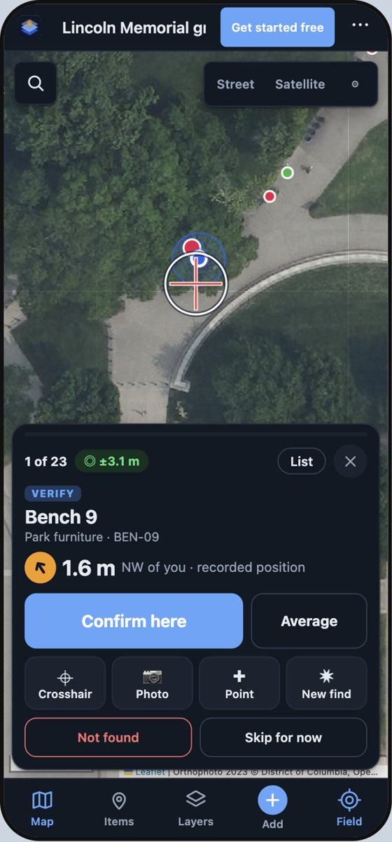
- Confirm, or record where it really is. At the spot, Confirm here records it verified with your GPS accuracy and how far it moved. If it's somewhere else, stand on it and record it there: that's moved, with the distance.
- Can't find it? Not found. It's logged, not deleted.
- Something not on the list? New find captures it with a photo, linked to the asset you're working near (or left for matching later).
- More than one location? Point adds extra locations to the same asset: pipe ends, each hydrant on a main, the corners of a slab.
- Poor GPS? Under trees or next to buildings, Average for 10 seconds, or place it on the aerial with the crosshair.
What you get back
Each asset gets an audit status (Verified, Moved, Damaged, Not found, Follow-up), condition 1–5, notes, photos, how it was positioned (GPS, averaged GPS, crosshair) and how accurate that was. Export → Audit pack gives you the table, every photo and the positions in one zip. See guide 4 for putting it on a dashboard.